What’s with the censored areas?
Not censored, it's just data drop-out happens from time to time after all the craft is 174.8 million miles from Earth, and those images have been transmitted to a Mars orbiter, then to a ground station on Earth and then transmitted to JPL, sometimes data gets messed up on the way :)
JPL sometimes orders the rover to re-transmit important affected images, check the image server again in a day or two and you may see these have been replaced with images that have no drop-out.
360 degree NavCam panorama assembled from 31 overlapping images. Note that several of the images have data drop out (small dark rectangles, but one can still see the terrain around the rover
360 degree NavCam panorama. Note there were a few images with data dropout, if JPL resend the complete images, I'll edit this post to include the full 360
I find it hard to believe NASA didn’t think of everything.
There is a risk that partial splits of the wheel could damage the rover's wiring, but they have a cunning plan to rip the affected part off before it can cause damage. The stongest part of the wheel would survive (the central rim) they could drive on that for years
They did think of everything they and everyone else knew at the time, but Mars rocks were more embedded in this part of Mars compared to those seen before. It was designed to last 2 Earth years, it's been running for 14, so all is good. It'll run for many more years :)
I recall when the first holes appeared in these wheels, all the doomsayers were telling the world its be unable to drive etc etc... that was a decade ago, and it is still roving, and climbing a mountain :)
Several years ago they did an engineering study that basically stated that when a specific number of cleats broke it had used up a percentage of its life. We're past that stage now. They have since developed a scenario that will allow them to rip one half of the damaged wheel off, and still drive on the remaining half.... All of the wheels are motorized, losing one wheel won't stop the rover from traversing to it's science waypoints
The very low temperatures encountered on Mars can embrittle some metals, but this damage is mostly caused by stress fractures after repeated bending of the grousers where after the thin skin was punctured years earlier.
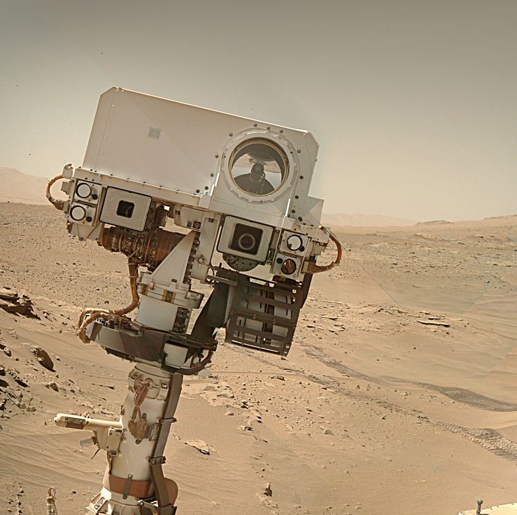
When this image was acquired the night time low temperature was -148° F (-100° C)
From what I hear from insiders it's not a pretty picture. Staff cuts have had a huge impact on the Mars missions, it's surprising some outreach functions are still working. The MSL raw image server is very fragile recently and goes down on a frequent basis. I have nothing but praise for those remaining staff for doing their best for holding what's left together. The redesign of the mission pages was a disaster, but there's no going back on that by the looks of things. I'm expecting what's left to deteriorate further if additional cuts are made. Watch this space
From the data that JPL got before the brownout the helicopter was only 1 meter from the ground when it all went wrong. Sadly the brownout meant no data from the IMU was saved in those last seconds before it landed. It must have experienced some pretty harsh vibrations. But it powered up again and has been communicating via the rover to Earth. It has sent back an incredible 2,396 images and a bunch of engineering data since the emergency landing (all those images are post landing) Link to the post landing images:- https://mars.nasa.gov/mars2020/multimedia/raw-images/?begin_sol=1036&end_sol=1136&af=HELI_NAV,HELI_RTE
Since deployment it has sent back 14,551 images (so far) and they will stay in touch with it until the rover drives out of Jezero when radio contact will be lost. The helicopter has no off button. It will wake up every morning that its batteries etc keep working, it will wait until a preset time and it will listen for a radio call from the rover for exactly 50 minutes, if it gets no call, it will go back to sleep, and awake the next day and repeat until its no longer able.
NASA's Perseverance rover captured this view of Deimos, the smaller of Mars' two moons, shining in the sky at 4:27 a.m. local time on March 1, 2025, the 1,433rd Martian day, or sol, of the mission. In the dark before dawn, the rover's left navigation camera used its maximum long-exposure time of 3.28 seconds for each of 16 individual shots, all of which were combined onboard the camera into a single image that was later sent to Earth. In total, the image represents an exposure time of about 52 seconds.
The low light and long exposures add digital noise, making the image hazy. Many of the white specks seen in the sky are likely noise; some may be cosmic rays. Two of the brighter white specks are Regulus and Algieba, stars that are part of the constellation Leo.
This is an annotated version of the image with those stars and Deimos labeled.
"Woodstock Crater," at center right, is roughly a half-mile (750 meters) away from the rover. At the time, Perseverance was making its way to a location called "Witch Hazel Hill."